Digital Twins – Virtual Cities for Real Change
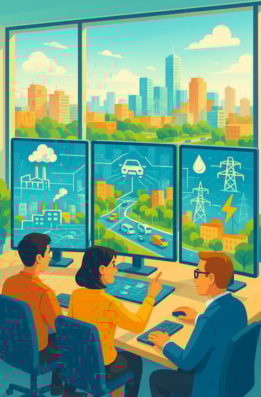
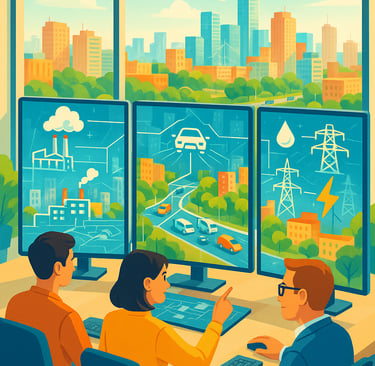
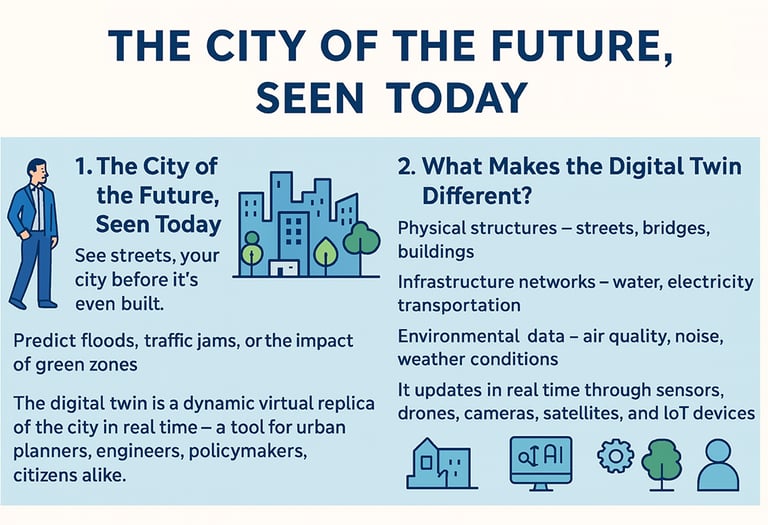
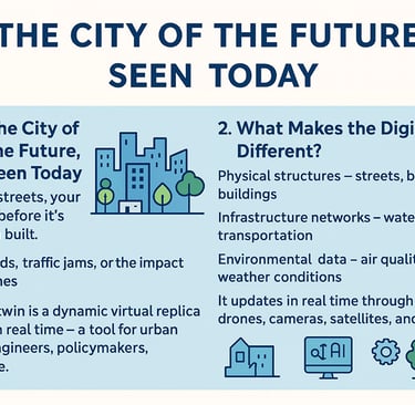
Imagine walking through your city before a single brick is laid or a single road is built. You can explore streets that don’t exist yet, see how traffic will flow, predict the impact of new parks or buildings, and even simulate how a flood or heatwave might affect different neighborhoods. This is the promise of a digital twin — a dynamic, virtual replica of a city that mirrors the real world in real time. It’s a powerful tool for urban planners, engineers, policymakers, and even citizens.
By: Toni Popovski / 17.10.2025
Seeing the City of Tomorrow, Today
Imagine walking through your city before a single brick is laid or a single road is built. You can explore streets that don’t exist yet, see how traffic will flow, predict the impact of new parks or buildings, and even simulate how a flood or heatwave might affect different neighborhoods.
This is the promise of a digital twin — a dynamic, virtual replica of a city that mirrors the real world in real time. It’s a powerful tool for urban planners, engineers, policymakers, and even citizens.
Digital twins are already revolutionising urban planning in cities like Singapore, Helsinki, Sydney, Bologna, and Aachen, providing leaders with better insights and giving communities a voice in shaping their future. (Eurocities)
For countries like North Macedonia, this technology offers an opportunity to leapfrog into the future, solving today’s pressing problems while planning smarter and greener cities for tomorrow.
What Makes a Digital Twin Different
A digital twin is much more than a fancy map or a 3D visualisation.
It is a living, breathing ecosystem that combines multiple layers of information:
Physical structures like roads, bridges, and buildings.
Infrastructure networks, including water pipes, electrical grids, and transport systems.
Environmental data, such as air quality, noise levels, and weather patterns.
Social and economic indicators, like population movement, energy consumption, or even citizen reports.
What makes it truly powerful is its ability to update constantly using data collected in real time from sensors, cameras, drones, satellite imagery, and IoT (Internet of Things) devices.
Instead of planning based on outdated or incomplete information, decision-makers have a continuously updated, precise picture of how the city functions — and how it might evolve.
The Technological Journey: How Digital Twins Are Built
Creating a digital twin is a multi-step process, combining advanced technology and close collaboration between different city departments, tech companies, and academic institutions. Here’s how it typically unfolds:
Step 1: Mapping the City in 3D
The first stage is to create a highly detailed 3D map of the city or a specific neighborhood. This is done using technologies like:
Lidar scanning, which uses laser sensors to capture accurate measurements of buildings and terrain.
Satellite imagery and drones to map large areas quickly and identify small details like rooftops or green spaces.
Architectural and engineering plans for buildings and infrastructure.
The result is a precise digital skeleton of the city — the foundation of the twin.
Step 2: Adding Live Data Streams
Next, real-time data is layered on top of the 3D model to bring it to life.
Sensors and digital systems feed continuous information into the twin, such as:
Traffic flow from smart traffic lights and GPS systems.
Water usage and pipeline pressure from utilities.
Air quality and temperature from environmental monitors.
Public transport schedules and passenger counts.
Emergency calls and response times from police and ambulance services.
This live data turns the twin into a mirror of the city, always reflecting current conditions. (OGC)
Step 3: Simulation and Prediction
Once the twin is populated with data, AI and predictive analytics come into play.
Planners can run “what-if” scenarios:
What happens if a major road is closed for construction?
How will a new residential block affect nearby traffic or public transport?
Which neighborhoods are at risk if a river floods or if air pollution spikes?
The system simulates these outcomes virtually, letting leaders test ideas and anticipate problems before they happen. (ScienceDirect)
Step 4: Feedback and Continuous Improvement
As decisions are implemented in the real world, new data flows back into the digital twin. This creates a feedback loop:
The twin helps guide actions.
Those actions are tracked in real life.
The results are fed back into the model to make it smarter and more accurate.
Over time, the twin becomes a powerful learning tool, continually improving its predictions and recommendations.
Step 5: Engaging Citizens and Stakeholders
Some cities go a step further by opening parts of their digital twins to the public.
This lets citizens:
Visualise proposed urban projects.
Understand the impact of changes before they happen.
Share their feedback through online consultations or workshops.
By making data visible and interactive, digital twins build trust and transparency, showing that planning decisions are evidence-based rather than politically driven. (GovPilot)
Global Examples: Lessons from Pioneering Cities
Several cities around the world have already shown how digital twins can transform urban planning:
Singapore created Virtual Singapore, a nationwide digital twin used for everything from traffic planning to disaster response. It allows planners to simulate the effects of new buildings on wind flow or test emergency evacuation strategies. Citizens can even explore the platform to better understand their city. (Smart City SS)
Helsinki uses its twin to experiment with green urban planning and climate adaptation strategies. Planners can model how new infrastructure will affect carbon emissions, traffic congestion, and air quality. (ResearchGate)
Bologna has developed a Civic Digital Twin, which integrates social dynamics and citizen participation, ensuring that planning decisions reflect the needs of local communities.
Aachen, a smaller city in Germany, shows how even municipalities with limited budgets can benefit from this technology. Their twin supports infrastructure maintenance and mobility planning. (European Transport Observatory)
Sydney, Australia, uses its twin to predict road accident risks by analyzing environmental factors like weather and traffic patterns. (Arxiv)
These global pioneers demonstrate that digital twins are not reserved for wealthy capitals — they are scalable tools that can be adapted to cities of different sizes and capacities.
Why This Matters for North Macedonia
Cities in North Macedonia face many challenges:
Traffic congestion that disrupts daily life.
High levels of air pollution in cities like Skopje and Tetovo.
Inefficient waste and water management systems.
Urban development that sometimes feels chaotic or poorly coordinated.
Digital twins could help address these issues by providing clarity and foresight.
Imagine Skopje having a platform where planners can:
Test traffic improvements before implementing them.
Identify pollution hotspots and simulate the effects of new green zones.
See how new construction projects would impact sunlight, wind, and drainage.
Prepare emergency response strategies for natural disasters
For citizens, this technology could mean greater involvement in decisions that shape their neighborhoods, leading to more transparent and democratic urban planning.
Challenges to Overcome
Of course, adopting digital twins isn’t easy. Cities must deal with:
Integrating data from many disconnected systems and departments.
Protecting privacy and ensuring data is used ethically.
Managing the cost of powerful computing and visualization tools.
Training staff and building expertise to maintain and interpret the twin.
Developing shared standards so that different systems work together. (OGC)
The key is to start small — perhaps with a single district or project — and grow over time through partnerships with universities, NGOs, and technology companies.
A Vision for the Future
Digital twins are not just technical tools; they are gateways to smarter, more inclusive governance.
For North Macedonia, adopting this technology could mean cleaner, more resilient cities where decisions are based on evidence, not guesswork, and where citizens have a clear voice in shaping their communities.
As local elections approach, it’s the right time to ask our leaders:
How will you use technology to plan for the future?
Will you embrace innovation that makes our cities more sustainable and democratic?
By investing in digital twins today, we can create a future where every decision — from a single traffic light to a new urban district — is guided by knowledge, transparency, and collaboration.
The cities of tomorrow are waiting to be built. With digital twins, we don’t have to wait to see them.